Bentley Project
Saskatchewan, Canada
Overview
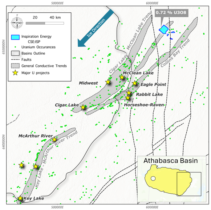
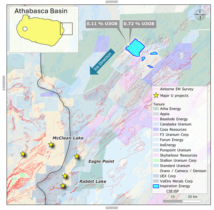
The Bentley Project is comprised of four mineral licenses encompassing a total land area of ~5,710ha (57km2) and is located 75 kilometers northeast of Cameco's Rabbit Lake mine. The Project sits on a potentially parallel structure to the Collins Bay Conductive trend that hosts the Rabbit Lake, Collins Bay and Eagle Point deposits. This environment has the potential for basement-hosted Uranium mineralization analogous to the Eagle Point model.
Exploration Targets
The most notable uranium showing on the property is located at the northern tip of the eastern shoreline of an unnamed small lake, ~15.3km to the east-southeast of Bentley Lake's eastern shore. Mineralization is found within a boulder of migmatitic biotite gneiss, corresponding to radiometric anomaly F-4, with scintillometer readings of 3900 counts per second (cps). Further analysis of the boulder revealed a U3O8 value of 0.11% (0.09% U) and 0.03% ThO2.
Another boulder proximal to the first corresponds to radiometric anomaly F-3 and comprises quartzose biotite gneiss, yielding scintillometer readings of 1500 cps. Assay results returned 0.72% U3O8 (0.69% U) and 1.98% ThO2.